BY: STAFF REPORT | BocaNewsNow.com
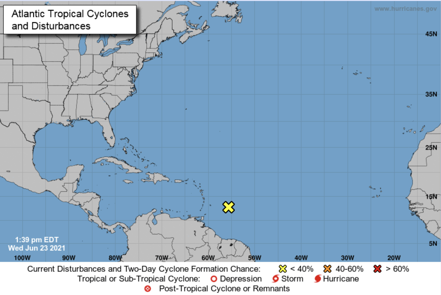
BOCA RATON, FL (BocaNewsNow.com) (Copyright © 2021 MetroDesk Media, LLC) — The National Hurricane Center continues to watch the wave marked by the yellow X above, and there is a new wave expected to form off the coast of Africa over the next few days.
It’s that second tropical wave that is now the focus of attention — it has the potential for “gradual” development.
At this moment, there is no threat to South Florida. While it is still early in the season, it is never too soon to craft your hurricane plan. If you’re new to South Florida, take the advice. Have a plan and be ready. If you’re waiting for a hurricane watch to be issued to take a storm seriously, you’re going to be in for a very unpleasant experience. Now is the time to store bottled water, canned food, and hurricane supplies like batteries. The best time to prepare is when there is nothing specific to prepare for.
From the National Hurricane Center Wednesday afternoon:
Tropical Weather Outlook
NWS National Hurricane Center Miami FL
200 PM EDT Wed Jun 23 2021
For the North Atlantic…Caribbean Sea and the Gulf of Mexico:
Recent visible satellite imagery indicates a weak area of low
pressure has formed along a tropical wave located a few hundred
miles east of the Windward Islands. However, shower and thunderstorm
activity associated with this low is limited. Increasing upper-level
winds are likely to prevent further development of this system as it
moves west-northwestward at 5 to 10 mph.
- Formation chance through 48 hours…low…10 percent.
- Formation chance through 5 days…low…10 percent.
A strong tropical wave is expected to emerge off the coast of
Africa over the next day or so. Some gradual development of this
system is possible by early next week while moving generally
westward over the far eastern Atlantic.
- Formation chance through 48 hours…low…near 0 percent.
- Formation chance through 5 days…low…20 percent.
