BY: WEATHER TEAM | BocaNewsNow.com
BOCA RATON, FL (BocaNewsNow.com) (Copyright © 2021 MetroDesk Media, LLC) — There is an 80 percent chance that the system marked by the ‘red x’ above will become the 18th named storm within a few days.
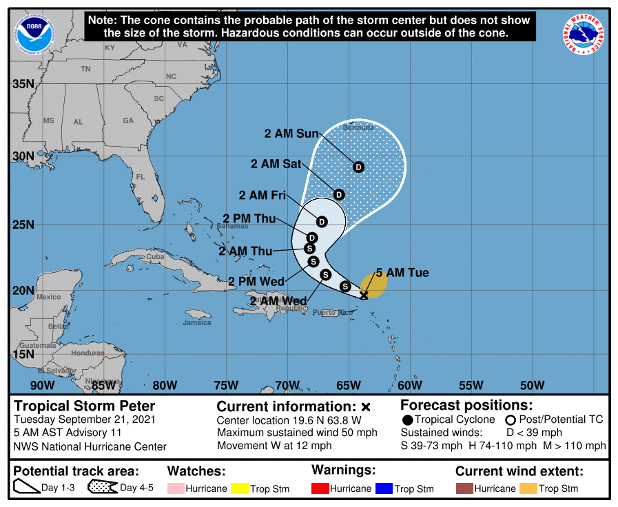
With Peter and Rose in various stages of dissipation or turning away from the U.S. Mainland, the red X is becoming a focus for forecasters.
An oval indicates where a system may form, not necessarily a direction of travel.
Sam is the next name to be used for a storm, followed by Teresa. Including Sam, only four names are left this hurricane season before names return to Greek letters.

This is the early morning outlook from the National Hurricane Center:
For the North Atlantic...Caribbean Sea and the Gulf of Mexico:

The National Hurricane Center is issuing advisories on Tropical
Storm Peter, located about 100 miles north of the northern Leeward
Islands, and on Tropical Storm Rose, located over the eastern
tropical Atlantic Ocean.

1. Showers and thunderstorms associated with a tropical wave located a
few hundred miles south-southwest of the Cabo Verde Islands continue
to show some signs of organization. Environmental conditions are
expected to become more conducive for development, and a tropical
depression is likely to form later this week while the system moves
westward at 10 to 15 mph across the eastern and central tropical
Atlantic Ocean.
* Formation chance through 48 hours...medium...50 percent.
* Formation chance through 5 days...high...80 percent.

2. A storm-force, non-tropical low pressure system, the remnants of
Odette, is located several hundred miles southeast of Newfoundland.
This low could acquire some subtropical characteristics during the
next few days while it moves slowly southeastward over warmer waters
across the north-central Atlantic Ocean.  However, the system is
expected to turn northward back over cooler waters this weekend,
which should end its chances of becoming a subtropical storm.
Additional information on this system, including storm warnings, can
be found in High Seas Forecasts issued by the National Weather
Service.
* Formation chance through 48 hours...low...10 percent.
* Formation chance through 5 days...low...30 percent.
