BY: WEATHER TEAM | BocaNewsNow.com
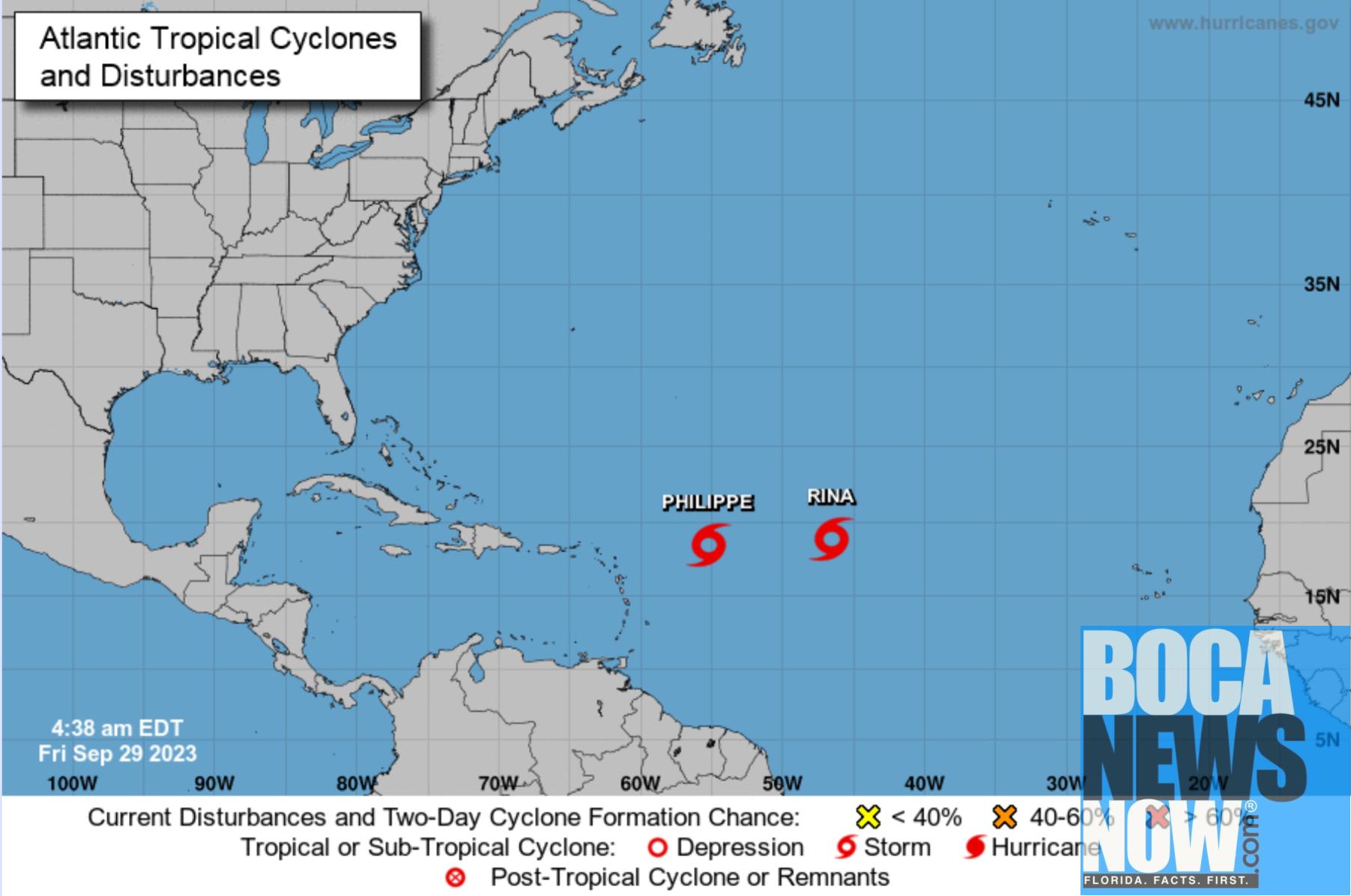
BOCA RATON, FL (BocaNewsNow.com) (Copyright © 2023 MetroDesk Media, LLC) — Tropical Storm Rina and Tropical Storm Philippe are both churning in the Atlantic east of Florida. Neither poses an immediate threat to Florida and it’s unlikely either will — although one model track, and just one model track, suggests Rina could turn to the west. Meantime, there’s another wave forming off the coast of Africa.
Here is the Friday update from the National Hurricane Center.
TROPICAL STORM PHILIPPE
Tropical Storm Philippe Discussion Number 24 NWS National Hurricane Center Miami FL AL172023 500 AM AST Fri Sep 29 2023
A 0546 UTC GMI microwave pass showed that Philippe continues to have a broad circulation, with the low-level center located somewhere near the northwestern edge of a large area of deep convection. There is a large range in the subjective Dvorak estimates (30-55 kt), but the various objective numbers from UW-CIMSS are in closer agreement (35-45 kt). Using a blend of these values, as well as ASCAT data from last evening, Philippe’s intensity is held at 40 kt.
While there is a bit of uncertainty in the exact location of the center, the storm does appear to be drifting toward the southwest (235 degrees) at about 2 kt. Philippe’s movement during the next 3-4 days is likely to be dictated by binary interaction with Tropical Storm Rina to the east. The bulk of the track guidance indicates that Philippe will dip farther toward the southwest during the next 48 hours due to Rina’s influence, but then turn toward the northwest and north on days 3 through 5 as a mid-tropospheric high builds over the central Atlantic. The new NHC track forecast is not much different from the previous prediction and is close to the TVCA and HCCA consensus aids. The HAFS regional hurricane models show little to no interaction between Philippe and Rina during the next few days. However, with the two storms located only 500 n mi apart from each other, some degree of interaction is likely, and therefore the western solutions shown by those models (near or over the northern Leeward Islands) appear to be outliers at this time. That said, there continues to be larger-than-normal uncertainty in Philippe’s future track.
A combination of shear, dry air, and Philippe’s proximity to Rina are likely to cause little change in intensity for the next day or so. However, the global models have trended toward Philippe not only surviving the next few days, but also deepening in an environment of increasing upper-level divergence (and still over very warm waters of 29-30 degrees Celsius). The NHC intensity forecast has been nudged upward from 36 hours onward, although it still sits well below most of the intensity models, including the consensus aids, during the latter part of the forecast period. Until it becomes more clear how Philippe will evolve over the next couple of days, the official intensity forecast will remain on the conservative side, but future adjustments to the forecast are becoming more likely.
FORECAST POSITIONS AND MAX WINDS
INIT 29/0900Z 18.5N 55.2W 40 KT 45 MPH
12H 29/1800Z 18.3N 55.4W 40 KT 45 MPH
24H 30/0600Z 17.9N 55.7W 40 KT 45 MPH
36H 30/1800Z 17.4N 56.0W 45 KT 50 MPH
48H 01/0600Z 17.1N 56.4W 50 KT 60 MPH
60H 01/1800Z 17.1N 56.8W 50 KT 60 MPH
72H 02/0600Z 17.6N 57.2W 55 KT 65 MPH
96H 03/0600Z 20.0N 57.9W 55 KT 65 MPH
120H 04/0600Z 23.1N 58.1W 55 KT 65 MPH
TROPICAL STORM RINA
Tropical Storm Rina Discussion Number 4 NWS National Hurricane Center Miami FL AL182023 500 AM AST Fri Sep 29 2023
Rina has become slightly better organized overnight. Deep, persistent convection, with cloud top temperatures less than -80 degrees C, has mostly obscured the low-level circulation. While the subjective satellite intensity estimates have risen this cycle to 45-55 kt, the objective estimates have generally held steady around 35 kt. The initial intensity is set to 40 kt to represent a blend of these estimates.
The intensity forecast is still unusually complex and therefore, unclear. While Rina appears to be gradually strengthening, most models agree that Philippe, the tropical storm to its west, will become the stronger storm. As Philippe becomes better organized, Rina is expected to be sheared and subsequently weaken. By days 4 and 5, as Rina potentially moves away from the influence of Philippe, the GFS and ECMWF do not show the environmental conditions becoming any more conducive and continue to weaken Rina into a remnant low. Only minor adjustments have been made to the latest intensity forecast.
Rina’s motion is estimated to be north-northwestward, or 340/4 kt. The storm is expected to move generally west-northwestward to northwestward through day 3. This is in part due to a binary interaction with Philippe and a mid-level ridge over the eastern subtropical Atlantic. Later in the forecast period, Rina is forecast to turn north-northwestward to northward in the flow between the subtropical ridge and an upper-level trough over the western Atlantic. There is still a large spread in the model solutions and thus, higher uncertainty in the track forecast, for the latter part of the forecast period. The model guidance envelope has generally shifted eastward this advisory cycle, and the latest NHC track forecast has been nudged in this direction. The official track forecast lies between the previous prediction and consensus aids, TVCN and HCCA.
FORECAST POSITIONS AND MAX WINDS
INIT 29/0900Z 18.9N 46.6W 40 KT 45 MPH
12H 29/1800Z 19.3N 47.1W 45 KT 50 MPH
24H 30/0600Z 19.8N 48.1W 45 KT 50 MPH
36H 30/1800Z 20.4N 49.6W 45 KT 50 MPH
48H 01/0600Z 21.1N 51.0W 40 KT 45 MPH
60H 01/1800Z 22.0N 52.8W 35 KT 40 MPH
72H 02/0600Z 23.3N 54.3W 35 KT 40 MPH
96H 03/0600Z 26.0N 56.0W 30 KT 35 MPH
120H 04/0600Z 28.1N 55.6W 30 KT 35 MPH

